Custom Panorama AI Assistent

Custom Panorama AI Assistent

Ever wished you could erase unwanted objects from your 360° panoramas within a second to improve your view of a windfarm or solarpark?

New in Windplanner: Custom Panorama AI Assistent.

Thanks to the Custom Panorama AI Assistent, it is now very easy to erase unwanted objects yourself. Upload your own 360° panorama and dive into the capabilities of the magic AI tool by clicking on “Start erasing objects”. Simply use the brush feature to selectively erase undesired elements. With a simple button press, witness the seamless disappearance of objects, transforming your panoramic and VR experience.

See the AI functionality in action in this Solarplanner video.


Custom Panorama AI Assistent

Target Capacity

Target Capacity

Enhance your project with our new editor, enabling you to establish a target energy capacity. Adding turbines or solar panels will boost the overall energy capacity of your project. Set the rated capacity for turbines easily in the 3D model parameters, and apply the same simple approach to solar panel models.


Target Capacity

Objectplanner for BESS projects

Objectplanner for BESS projects

Objectplanner can also be used for BESS projects (Battery Energy Storage System)? Our database of models is continuously growing and various objects such as containers, fences and mitigation measures are already available to put together your own BESS configuration.

Objectplanner for BESS projects

Street View is now also widely available in Germany

Street View is now also widely available in Germany

Street View is now also widely available in Germany. In combination with photogrammetry from Google, you can create a photo-realistic representation of your wind project in less than 1 minute.

Take your wind projects to the next level in minutes with Google Street View visualizations in Windplanner!

Street View Integration: Visualize your wind project from any street and move freely in a real world environment.

Engage Stakeholders: Enhance communication by sharing realistic visualizations with stakeholders, land owners, and communities in a fast, efficient and cost effective way, resulting in less resistance.

No Street View available or do you need visualizations from a backyard?
Our Spherical Panorama upload module allows you to upload your own 360 degree photo’s in Windplanner from any location or height.

See how it works.


Street View is now also widely available in Germany

International recognition

International recognition for Windplanner

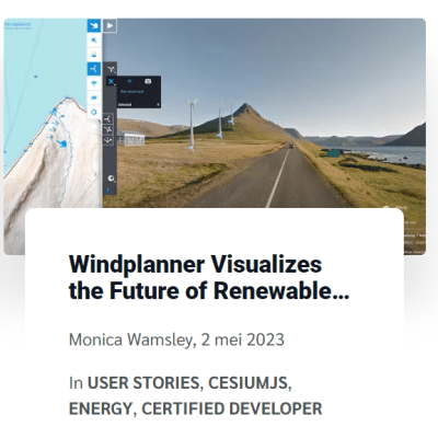
Windplanner Visualizes the Future of Renewable Energy with CesiumJS
Cesium wrote an article about us, about how we visualize the future of renewable energy.

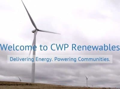
Windplanner, a Cesium Certified Developer, offers a powerful tool for visualizing renewable energy projects. Using @CesiumJS, Windplanner allows users to see how wind turbines, solar panels, transmission lines, and energy storage systems will appear in their surrounding area. The tool provides 2D and interactive 3D views, incorporating buildings, terrain height, trees, and existing as well as proposed energy infrastructure. By presenting clear and realistic representations of the changes, Windplanner helps address concerns and garner support for local renewable projects.

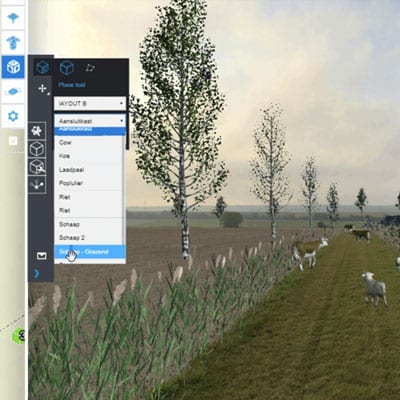
To create accurate visualizations, Windplanner uses panoramic photos from various sources, such as user libraries or suppliers like Google Street View. These photos are combined with Cesium World Terrain to offer detailed and up-to-date representations of the project areas. Users can select predefined turbine models or customize their own, adjusting parameters like hub height, rotor diameter, wind direction, and color. They can also set specific dates and times to evaluate shadow effects caused by turbines or solar panels. Windplanner incorporates Cesium OSM Buildings and Bing Maps Aerial imagery to provide geospatial context.

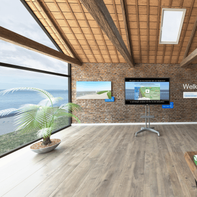
The tool enables collaboration among planners, residents, and decision-makers by allowing the sharing of interactive viewpoints. Users can present proposed layouts and locations and even experience the projects in virtual reality for a more immersive perspective. By leveraging Cesium’s capabilities, Windplanner enhances visualization and communication for energy projects worldwide by providing real-world data for discussions and decision-making.

Click here, to watch the full article:

International Recognition

Windplanner 2.13.0

All new functionalities in Windplanner 2.13.0

Windplanner introduces its latest module, Lineplanner, designed to showcase the visual impact of high-voltage pylons on the environment. Developed in close collaboration with a prominent TSO, this powerful tool takes the energy transition to new heights.

Curious about the enhancements? Dive into the detailed release notes click here!

New in Windplanner 2.14.0

Windplanner 2.13.0

All new functionalities in Windplanner 2.13.0

There is a new version of Windplanner online with all new functionalities, including an improved version of our panorama mask and better quality solar panels. A brief example in this video.

For more info, check our release notes

New in Windplanner 2.13.0

Virtual Consultation Room

Virtual Consultation Room for better engagement with your stakeholders

Do you want better and uninterrupted engagement with your stakeholders?

We have developed what we call a Virtual Consultation Room (VCR): an online 360 degree interactive platform.
In this virtual environment room, you can show and or share whatever information about your project you wish to use. This can be for information, clarification, to show options and alternatives etc. There are unlimited options but we think that using the virtual Consultation Room for actual consultation is probably most beneficial because it gives stakeholders the opportunity to participate, ask questions, make suggestions etc.

We have designed multiple ‘template’ rooms which you can use or we can create a ‘bespoke’ room fully in accordance with for example your corporate colours, design etc. Based on our experience to date we are confident your VCR will reach a wider target group and your stakeholders will get a better understanding than when using traditional methods.  This is particularly the case in situations where a silent majority may be neutral or cautiously supportive but not brave enough to publicly being seen to supportive in the face of fierce opposition.

We produced a VCR for the WindEnergy expo in Hamburg and used it to demonstrate our products and services as well as showcasing some real life examples.

Our VCR hosts will give you a warm welcome in: English, German, French, Spanish and, with a bit of luck: Dutch.
On this page, you can find more information about the VCR.

Virtual Consultation Room

New: objectplanner

New: objectplanner

New: Objectplanner: our powerful additional platform fully integrated with
Windplanner and solar planner.

The latest addition to our ‘Windplanner’ design and visualisation suite makes it possible to add a theoretically unlimited range of what we have called ‘objects’ into your project’s 3D (and 2D) world.  Objects, such as for example trees and hedgerows may be introduced  to screen some or all of a proposed development and so mitigate some of the effects on views.
Other ‘objects’ such as livestock, cars or farm vehicles might be used to generate more engaging visual images.

The use of planting in mitigation is well established as is indeed the introduction of people, play equipment etc in visual images.  No other software does however give you the capability to edit your mitigation measures in ‘real time’ and in 3D.  For example when designing landscape screening proposals, size, proportions, planting density, species etc in combination with stock fencing will all influence the overall visual character of the view.Because all objects can be scaled you can also illustrate growth.

The capability of wind and solar planner which already facilitates outputs of high quality 3D images has now gone up another level with Object planner.  The  package currently included > 20 objects.  Your required  object not available: call us and we will create it.

Objectplanner will be free until 01/01/2023. If you are interested to learn more about Objectplanner, please contact our sales department.

New: Objectplanner

🌏 Windplanner goes “Downunder”!

CWP renewables as a new customer

The start of a great collaboration with CWP renewables as a new customer. They will use Windplanner in the development of several windprojects. Together we contribute to a clean future, each from our own perspective.

CWP Renewables is a renewable energy company that develops, operates and owns renewable energy assets in Australia.

Our Windplanner software is user-friendly and gives CWP the possibility to take and import orb photos themselves. In addition, we help them with highly accurate terrain data in the Windplanner software.

🌏 Windplanner goes “Downunder”!