Planner features
Windplanner
Create and place turbines to visualize changes in the living environment
Solarplanner
Visualize and customize solar farms in the 2D and 3D world.
Lineplanner
Place and visualize different types of pylons and stations.
Objectplanner
Customize and place objects like trees, animals and fences to showcase mitigating measures that are involved in your project
GIS data
Import every type of data layer into Windplanner
Panorama View
Make a photorealistic representation of changes in the living environment
Animations
Make beautiful promo animations to show to your clients
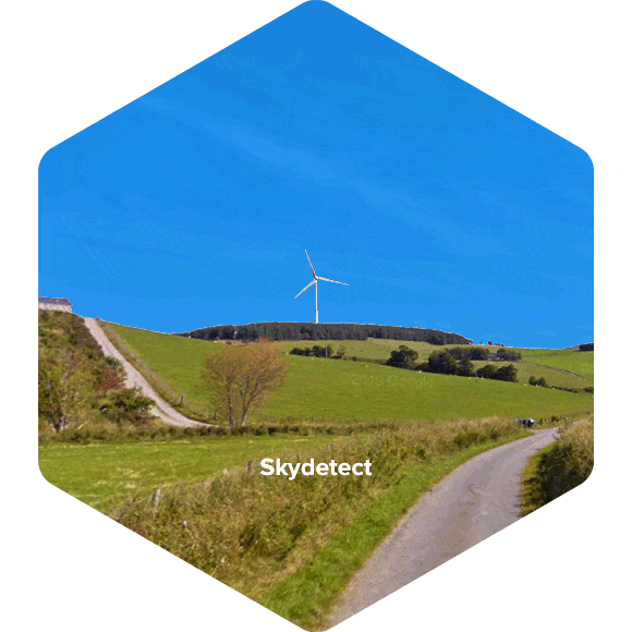
SkyDetect
Automatically cut out the sky in a panorama resulting in photorealistic representations of changes in the living environment
Simulations
Simulate the impact of shadow flicker, noise and zone visual impact
Photomontages
Create photo montages on the fly. Choose one of three options to position the turbine in the surroundings exactly where you want it to be:
- SkyDetect: this is a clever algorithm that cuts out the sky from a panorama, automatically creating photomontages that fit most cases.
- Manual Masking: with this tool, you can manually adjust the skyline if SkyDetect fails. And, for instance, if you want to position a turbine in front of the mountain but behind the trees.
- No mask: in this option, the turbine will be placed in front of all objects.