Solar performance
Our development team has worked extensively to increase the performance of the solarmodule, to make sure the loading time of a solarpark is reduced, so you can easily visualize and see the modifications much faster than before.
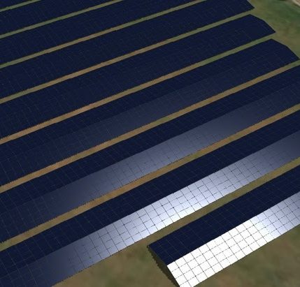
Our development team has worked extensively to increase the performance of the solarmodule, to make sure the loading time of a solarpark is reduced, so you can easily visualize and see the modifications much faster than before.
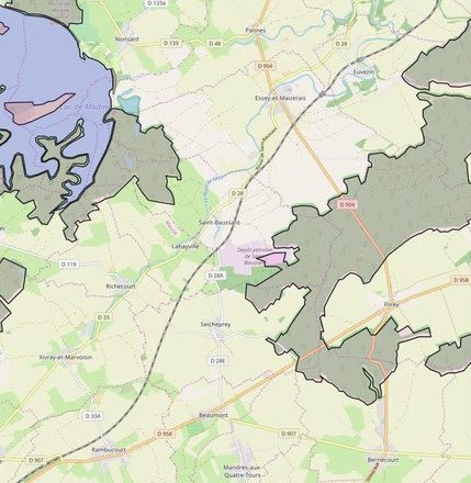
It’s now possible to upload a map layer for one specific project, so the map layer won’t appear in the map layer list of any other project. This will increase loading time and you will only see the map layers you need for the specific project
More frequently, we have received requests for higher detailed terrain and satellite imagery in some areas. In many countries, we have contact with suppliers from those data. If you have this data for a specific area yourselves and you would like to integrate this, please contact sales.
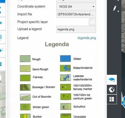
From now on, it’s possible to upload a legend for every map layer. This legend will give more information to the map layer you have uploaded.